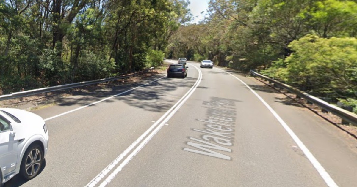




Wakehurst Parkway Rock Wall Work to Begin Near Oxford Falls Road

Construction on the Wakehurst Parkway upgrade will continue near Oxford Falls Road, with rock breaking, stabilisation, earthworks, drainage and utility work planned.


In September, work will continue between Trefoil Creek and Oxford Falls Road, where crews are preparing to widen the southbound side of the parkway and build a larger sandstone retaining wall near the intersection.

Oxford Falls hillside to be cut back for 230-metre wall

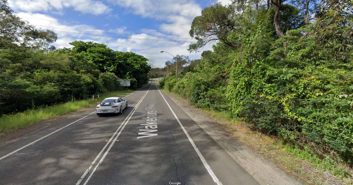
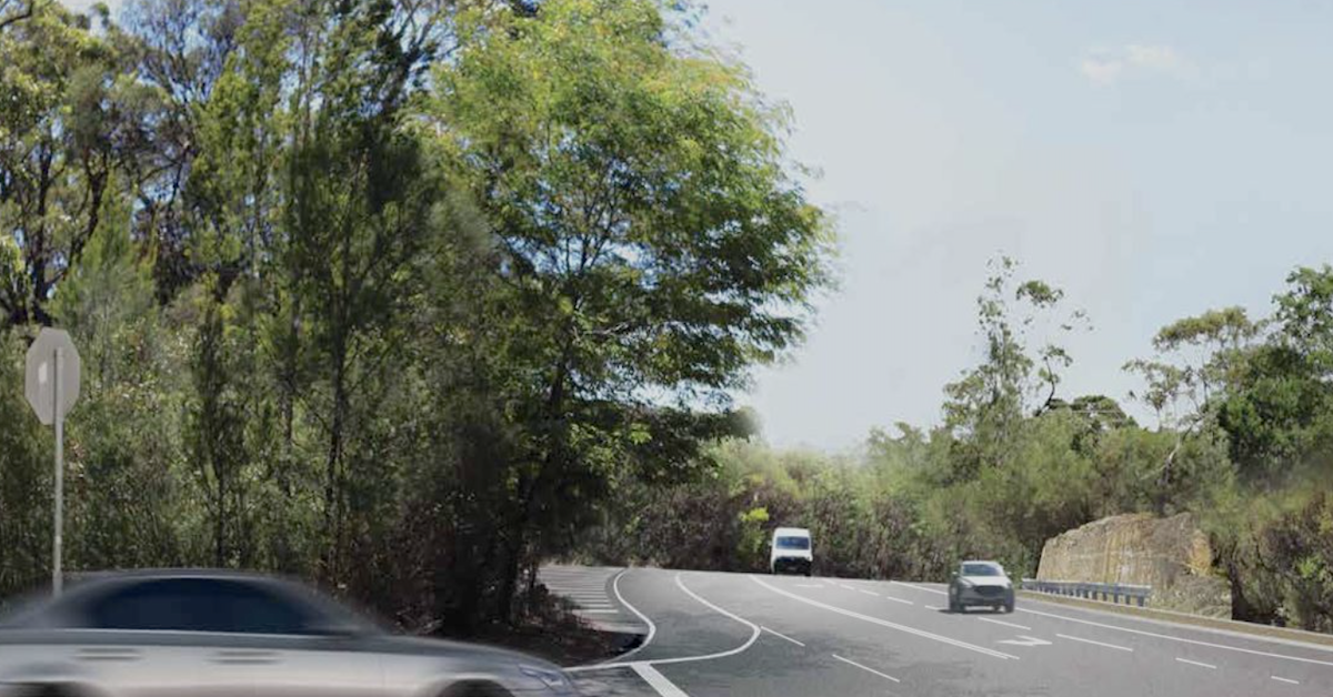
The road widening requires crews to cut into the existing hillside on the southbound side of Wakehurst Parkway, where a smaller rock wall is currently located.

The retaining wall will be extended and enlarged to about 230 metres in length and up to 4.4 metres in height. Transport for NSW says the finished wall will be designed to resemble the sandstone rock faces already found along Wakehurst Parkway.
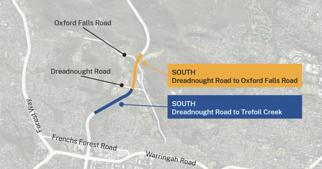
Photo Credit: Transport for NSW

Sections of the rock face needing additional support will be stabilised with rock bolts and shotcrete. Rock bolts involve steel bars being inserted into drilled holes to reinforce the rock, while shotcrete is concrete sprayed directly onto the rock surface at high pressure.

Any shotcrete used will be colour and texture-matched to the surrounding sandstone.

Excavated sandstone may also be crushed and processed for reuse as fill elsewhere within the project. The approach would reduce the amount of material sent to landfill while allowing excavated rock to be reused on site.

After-midnight rock breaking scheduled near Oxford Falls Road

September works will take place during standard construction hours and at night.

Standard hours are Monday to Friday from 7:00 a.m. to 6:00 p.m. and Saturdays from 8:00 a.m. to 1:00 p.m.. Out-of-hours work may take place between 8:00 p.m. and 6:00 a.m.

Rock breaking near Oxford Falls Road west will include some noisy work after midnight. Nearby residents will be contacted before higher-impact activities take place.

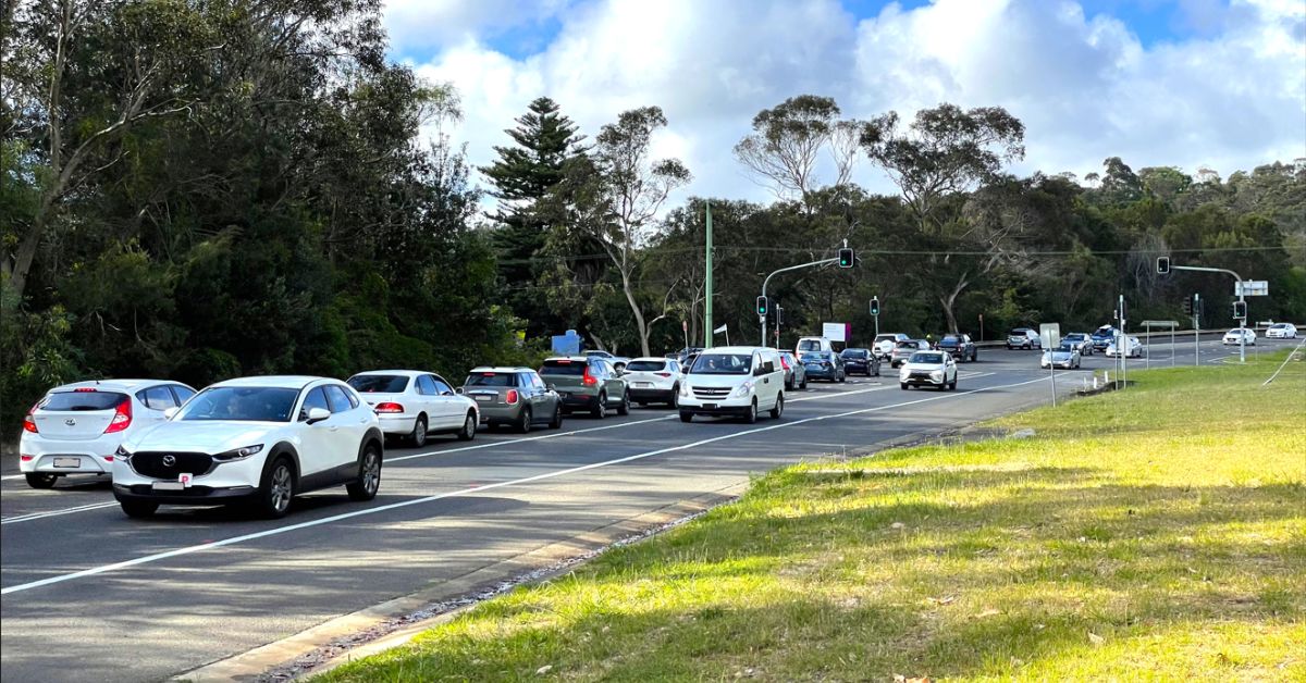
Temporary lane closures and reduced speed limits may be introduced while work is underway, with traffic controllers and signage directing motorists through changed conditions.

Work may generate noise, light and vibration, while workers and construction vehicles will continue moving through the site.

Measures planned to reduce disruption include non-tonal reversing alarms, watering exposed areas to manage dust and targeted lighting to minimise light spill. Oversized deliveries are expected to take place later at night when traffic volumes are lower.

Rare Angus’s Onion Orchid salvaged from work area

Environmental work near Oxford Falls Road has also involved the salvage of a threatened plant species found in only a small number of locations on Sydney’s Northern Beaches.

Microtis angusii, commonly known as Angus’s Onion Orchid, was identified near the construction area before work began in that section. The orchid has a single hollow, onion-like leaf and can produce up to 60 small green flowers.

Flora ecologists worked with the project team to recover the plants before construction moved into the affected area. The salvaged orchids were donated to the Australian Botanic Garden Mount Annan.

The orchid salvage forms part of environmental management work associated with construction along the Wakehurst Parkway corridor.

September program follows construction that began in June

Construction on the Wakehurst Parkway improvement project began on 1 June after several years of planning and design. Early works included vegetation clearing, installation of safety barriers and temporary fencing, excavation and drainage activity along the southern section of the corridor.


The broader upgrade covers sections between Frenchs Forest and Narrabeen and includes intersection changes, additional lanes, flood mitigation works and safety improvements.

Published 27-Aug-2026
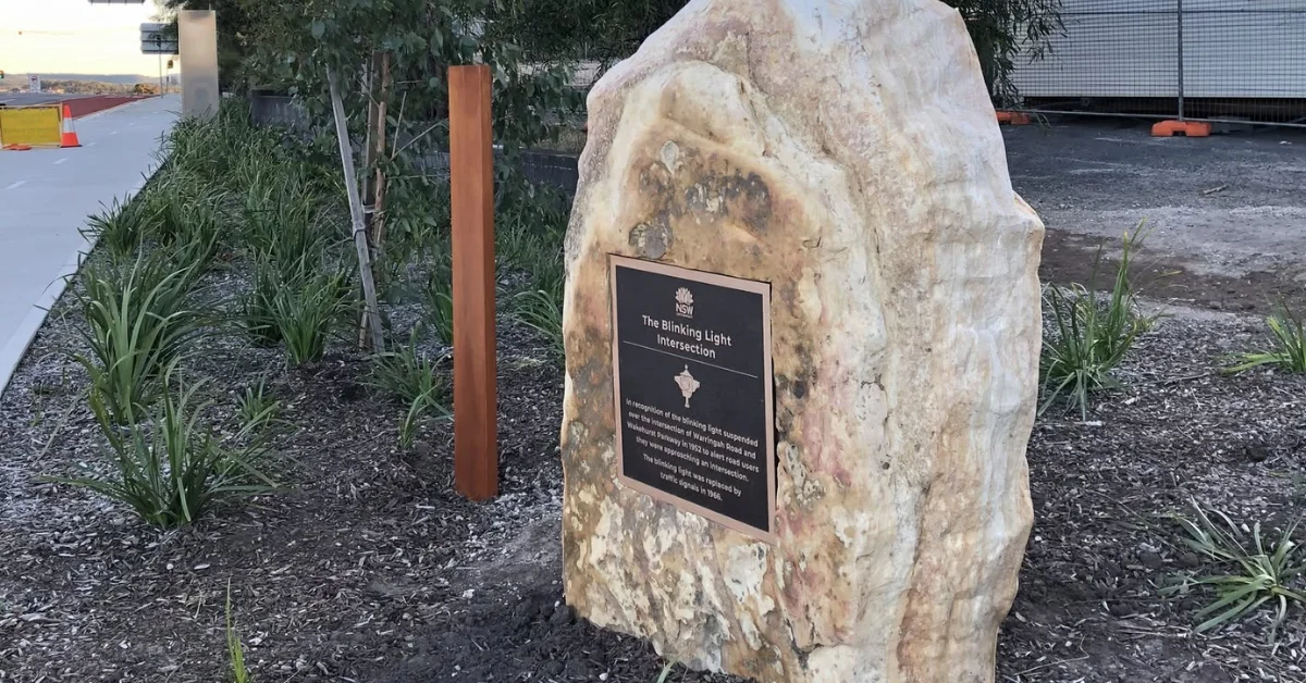
Blinking Light Plaque To Restore A Familiar Frenchs Forest Marker

The Blinking Light plaque in Frenchs Forest is set to return later this year, restoring a marker for an intersection name that has remained familiar to generations of northern beaches residents.


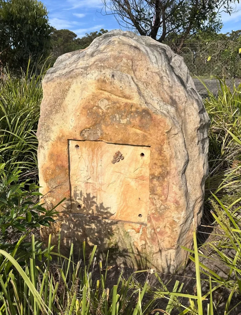
The bronze plaque was stolen from its sandstone plinth at the corner of Warringah Road and Wakehurst Parkway in February 2026. Its disappearance prompted disappointment among residents, including people who still refer to the junction as the Blinking Light Intersection decades after the original beacon was removed.

Transport for NSW is now investigating a suitable replacement, which is expected to be installed later in the 2026 calendar year.

Blinking Light plaque stolen
Photo Credit: Trevor Watson/Lost Manly Northern Beaches (LMNB)/Facebook

A Frenchs Forest Name That Lasted

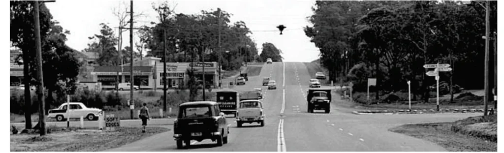
The Blinking Light name dates to October 1952, when an experimental warning beacon was suspended above the intersection.

At the time, Warringah Road and Wakehurst Parkway had been dirt tracks through bush, with the junction having been the scene of multiple high-speed collisions. The blinking signal was introduced to test whether a beacon could encourage motorists to slow as they approached potentially dangerous intersections and allow enough time to stop if necessary.

Blinking Light plaque
Photo Credit: Trevor Watson/Lost Manly Northern Beaches (LMNB)/Facebook

The light soon became a local landmark. Although traffic signals replaced it in 1966, the name remained part of local usage.

That connection was evident after the plaque was stolen. Residents recalled travelling through the area during the 1960s, while others said they had continued to call the junction the Blinking Light long after the beacon itself disappeared.

Changes To The Intersection

The intersection has undergone several upgrades since the original signal was removed.

Later works associated with increased traffic around the Northern Beaches Hospital substantially changed the junction. Warringah Road was widened to 12 lanes, including a four-lane slot for through traffic, while an overpass was built for Wakehurst Parkway.

Blinking Light intersection
Photo Credit: Transport NSW

During the upgrade period, Roads and Maritime considered formally recognising the Blinking Light name as a tribute to the area’s history. A community working group was established to consider how the intersection could be commemorated.

The current layout opened in 2020.

Blinking Light Plaque Marked The Earlier Junction

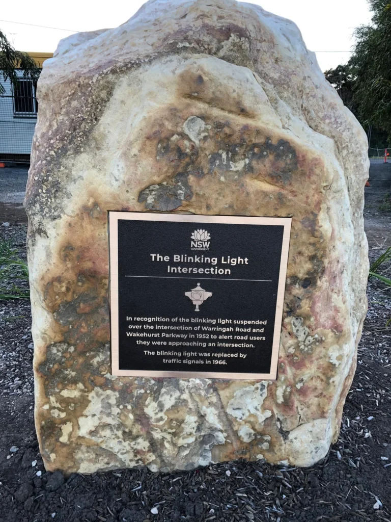
A commemorative bronze plaque was unveiled in 2021, recognising the blinking light that had once hung above the intersection.

Placed on a sandstone plinth on the north-eastern corner of the junction, the marker recorded that the beacon had been installed in 1952 to alert road users approaching the intersection and had been replaced by traffic signals in 1966.

The plaque remained there until its theft in February.


The loss prompted calls for the marker to be replaced, along with a request for measures to better secure its successor against another theft.

Transport for NSW has confirmed it is aware of the missing Blinking Light plaque and is investigating a suitable replacement. The new marker is expected to be installed later this year.

Published 31-July-2026

Classroom Air Quality Under Scrutiny at Davidson High School

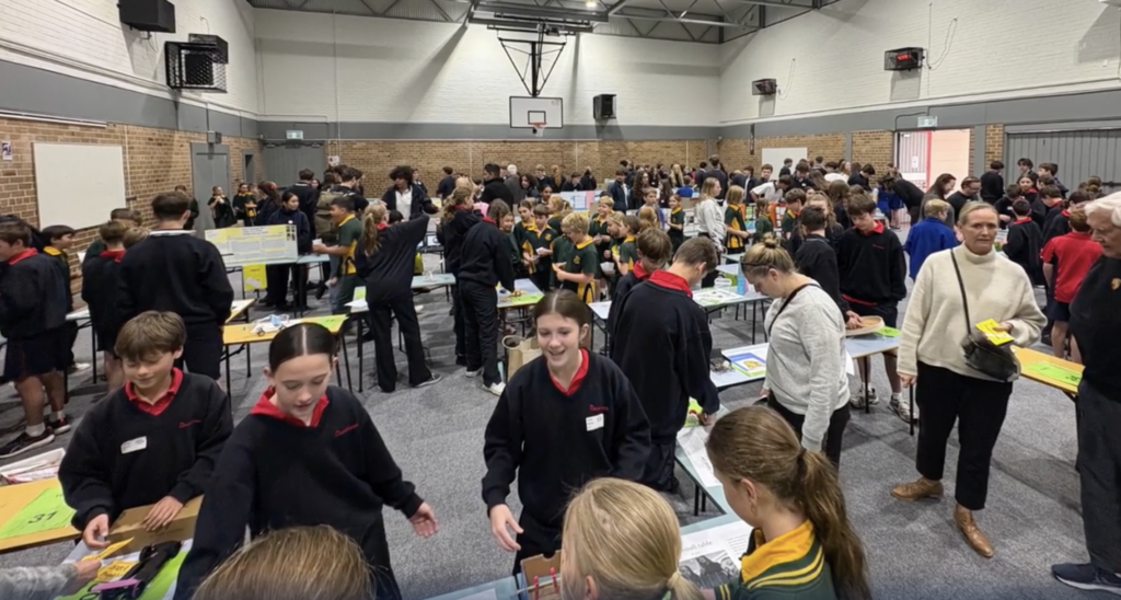
Davidson High School was among 59 public schools selected for a major NSW air quality study that found some classrooms across the state were not meeting ventilation levels considered optimal for student learning.


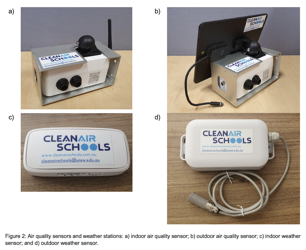
The Frenchs Forest school participated in the Clean Air Schools Program, a joint initiative between the NSW Department of Education and UNSW Sydney that monitored indoor and outdoor air quality between 2023 and 2025.

The final report examined carbon dioxide (CO₂), fine particulate matter (PM2.5) and nitrogen dioxide (NO₂) levels at schools across Sydney, Newcastle and Wollongong. Researchers collected air quality data from one classroom and one outdoor area at each participating school.

While the study identified 17 schools where the monitored classroom recorded carbon dioxide levels above the recommended 850 parts per million threshold for much of the school day, individual school results have not been publicly released. As a result, it is not known whether the classroom monitored at Davidson High School was among those identified by researchers.

A school in an area affected by traffic and bushfire smoke events

Davidson High School is located in Frenchs Forest, an area that sits between major transport corridors and bushland reserves on Sydney’s Northern Beaches.

The school is close to Wakehurst Parkway and the Northern Beaches Hospital precinct, both of which generate significant daily traffic movements. At the same time, the area has experienced the impacts of major bushfire smoke events that have affected northern Sydney during previous fire seasons.

One of the report’s key findings was that pollution sources near schools are often highly localised, with traffic and industry among the factors that can influence outdoor nitrogen dioxide levels.

Researchers also noted that the monitoring period occurred during a time of relatively good air quality, with few major bushfires, prescribed burns or dust storms affecting NSW. As a result, the study was unable to assess how well classrooms protected students during severe smoke events.

While individual results for Davidson High School were not published, the report highlights the importance of understanding how both local traffic and seasonal smoke events may influence air quality around schools.

Photo Credit: Davidson High School

What researchers found across NSW schools

The study also found that most classrooms exceeded the recommended carbon dioxide threshold at some point during the day, although these exceedances were often short-lived.

Three schools — Condell Park High School, Hebersham Public School and Mayfield East Public School — consistently recorded carbon dioxide levels above 1000 parts per million throughout much of the school day.

Researchers concluded there was evidence that some NSW classrooms were exceeding levels considered optimal for student learning and health. Carbon dioxide is commonly used as an indicator of ventilation performance. Elevated levels do not necessarily mean a classroom is unsafe, but they can indicate that fresh air is not entering a room quickly enough.

The NSW Department of Education has stated that the report did not find that classrooms were unsafe and has begun follow-up assessments.

One classroom, one school

An important limitation of the study was that only a single classroom was monitored at each participating school. Researchers acknowledged this means the results may not be representative of conditions elsewhere on the same campus.

The report noted that understanding air quality across an entire school would require monitoring a wider range of classrooms over a longer period.

Photo Credit: UNSW

Ventilation emerged as a key finding

One of the strongest findings in the report was the role of classroom design and ventilation.

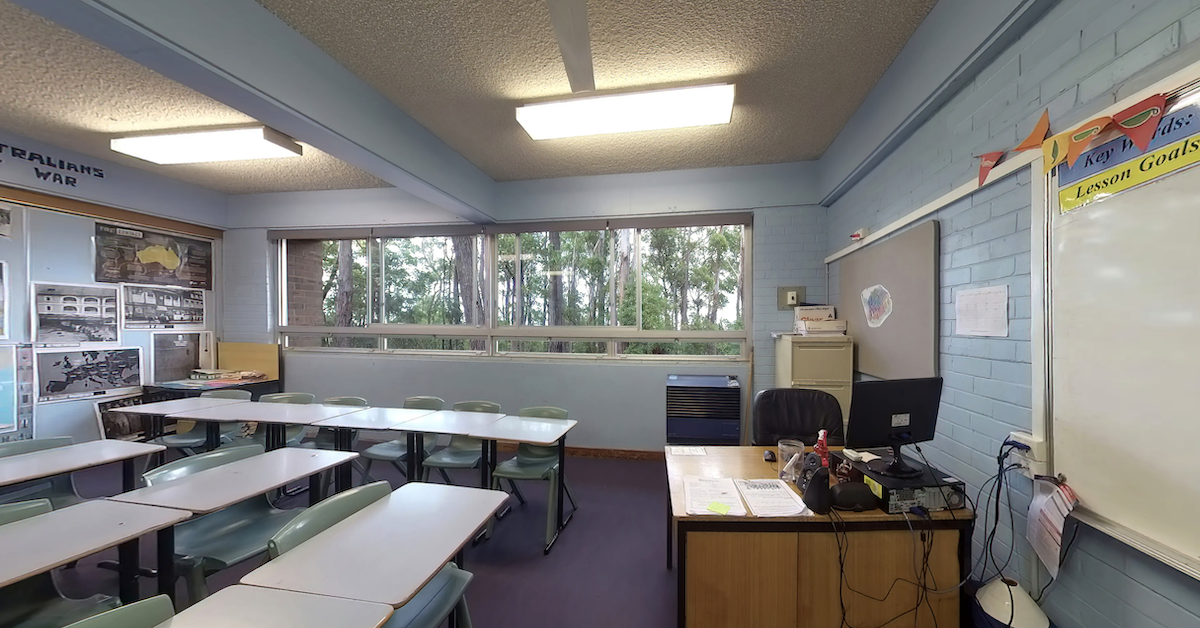
Researchers found classrooms with cross-ventilation — where windows can be opened on multiple sides of a room — generally recorded lower carbon dioxide levels than classrooms without cross-ventilation.

Schools participating in the NSW Government’s Cooler Classrooms Program also tended to record lower carbon dioxide levels than schools relying primarily on split-system air-conditioning.


The report found that classrooms without cross-ventilation and without Cooler Classrooms upgrades recorded the highest average carbon dioxide levels.

Researchers recommended accelerating the installation of mechanical filtered ventilation systems, particularly in schools identified as having consistently poor natural ventilation.

Published 10-June-2026

Construction Has Started on Wakehurst Parkway — Here’s What Frenchs Forest Residents Need to Know

An $85.1 million improvement project on Wakehurst Parkway is now under way, with crews working along the southern section between Frenchs Forest Road and Oxford Falls Road.


Construction began on 1 June. The project has been in planning and design for several years and aims to address two of the road’s most persistent problems: flooding that has repeatedly closed the parkway and traffic bottlenecks at key intersections. For Frenchs Forest residents who use the route daily to reach Northern Beaches Hospital, Warringah Road and the broader road network, the works represent the most significant upgrade to the corridor in decades.

Construction contractor Ertech Pty Ltd is carrying out the works on behalf of Transport for NSW.

Current works and traffic changes

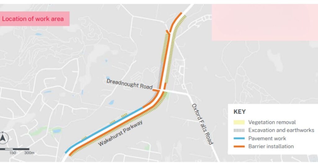
June works are concentrated in the southern section between Frenchs Forest Road and Oxford Falls Road. Crews are installing safety barriers and temporary fencing, clearing vegetation, carrying out earthworks and excavation, installing temporary asphalt to allow barrier placement, and carrying out drainage work.

Photo Credit: Transport for NSW

Standard working hours run Monday to Friday from 7am to 6pm and Saturday from 8am to 1pm. Up to ten night shifts are scheduled for June, running Sunday to Thursday from 8pm to 6am, with noisy work completed before midnight. Oversized deliveries will be scheduled for later at night when traffic is lighter.

Photo Credit: Transport for NSW

Some temporary traffic changes will be in place during night works. Access to all properties will be maintained throughout.

The full scope of improvements

The project delivers upgrades across two geographic sections of the parkway. In the southern section, key works include:

  • Intersection upgrades at Dreadnought Road
  • New bus stops and a signalised pedestrian crossing
  • A new southbound left-turn slip lane and extended right-turn bay
  • New lanes in both directions between Dreadnought Road and Oxford Falls Road
  • Intersection upgrades at Oxford Falls Road, including a new southbound right-turn bay and a dedicated northbound left-turn lane
  • Flood mitigation works in the southern section
  • Widening of the southbound lane between Oxford Falls Road and Frenchs Forest Road to create dual lanes
Photo Credit: Transport for NSW

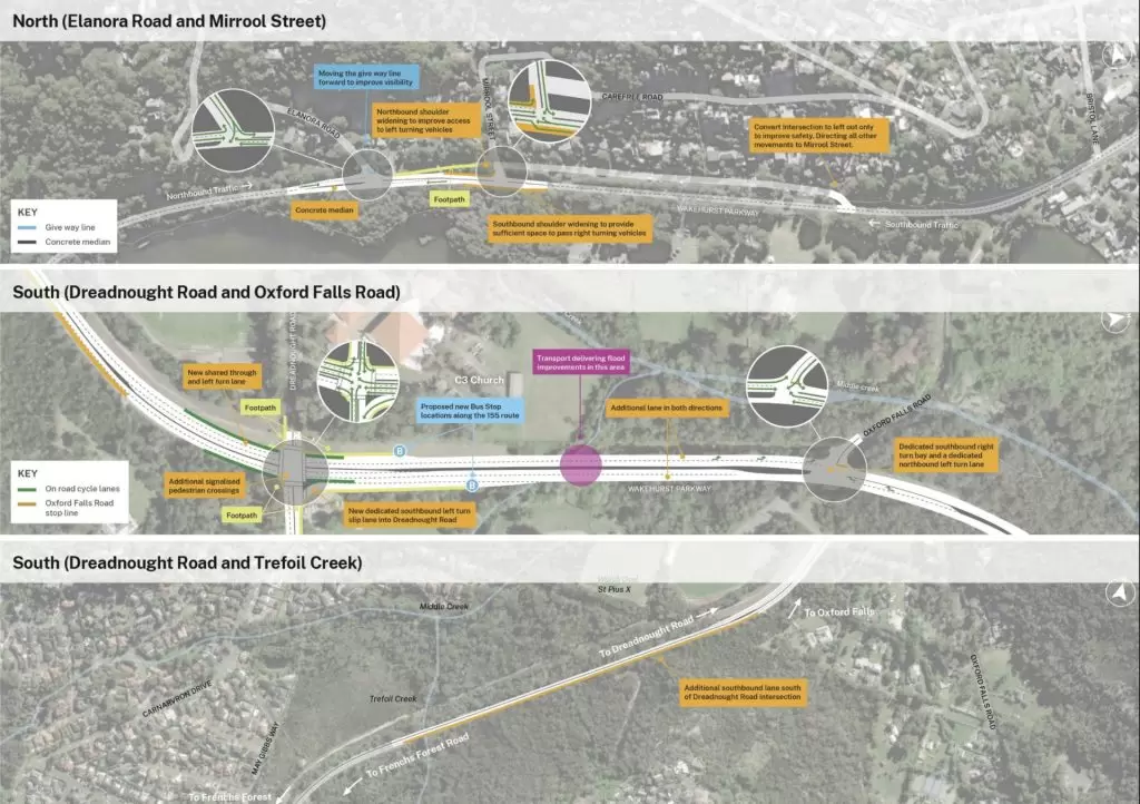
In the northern section at Elanora Road and Mirrool Street, the project includes shoulder widening in both directions, a relocated give-way line at Elanora Road to improve sight lines, and conversion of the service road near Palm Terrace to left-out only to direct traffic through Mirrool Street.

Following community feedback received last year, the Elanora Road design was refined to keep the informal holding bay in place, shift the centre line slightly (by up to 1.5 metres) to improve separation  between traffic directions, and add painted chevron medians to encourage lower speeds. The staged approach means if safety improves the holding bay can remain, and if it does not, more substantial treatments can be added.

Photo Credit: Transport for NSW

Wildlife protection built into the works

The parkway corridor runs through bushland that supports a range of native species, and the project includes significant fauna measures.

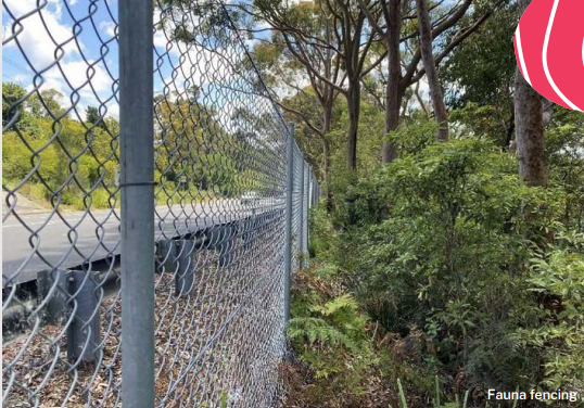
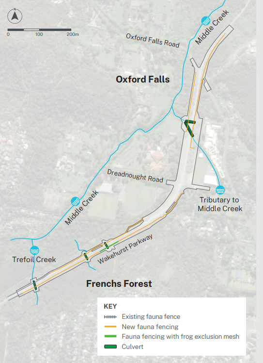
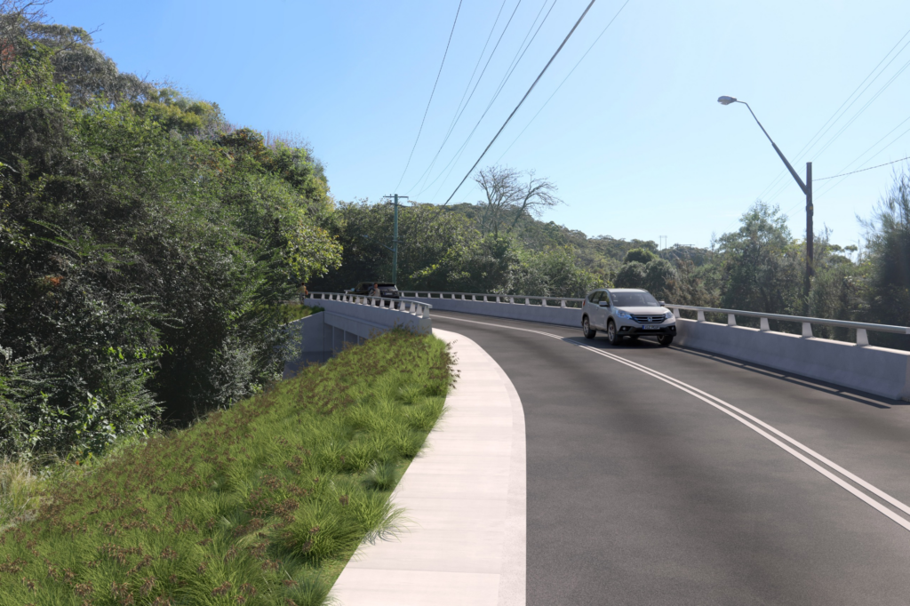
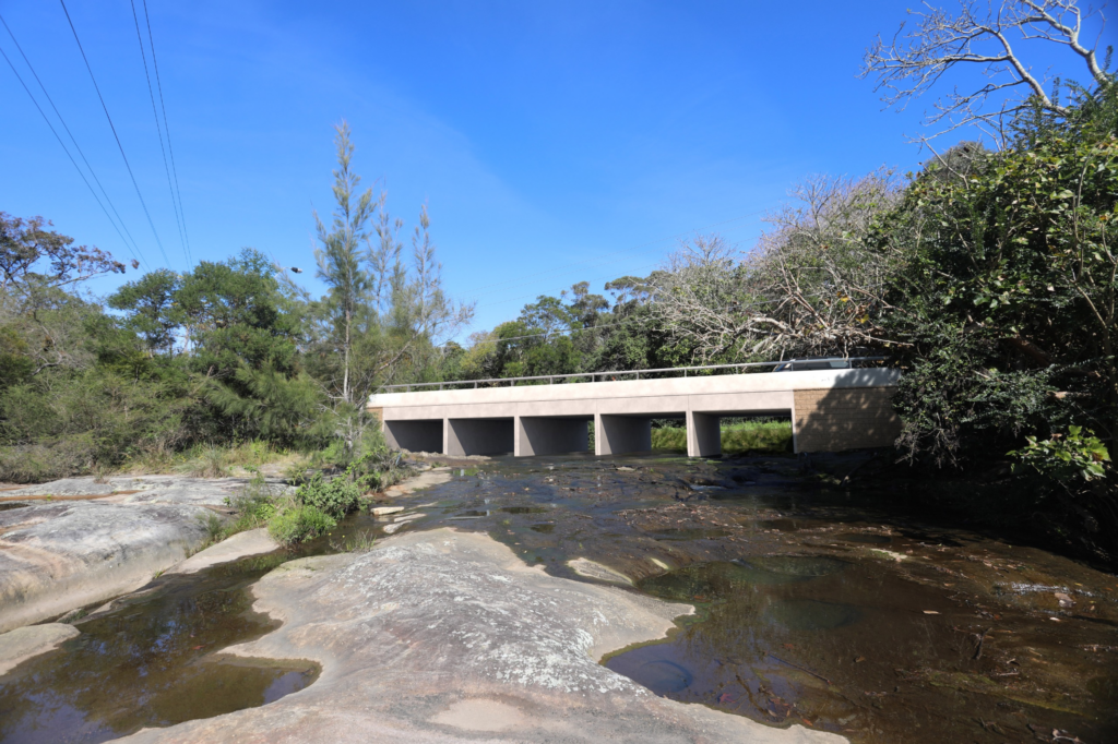
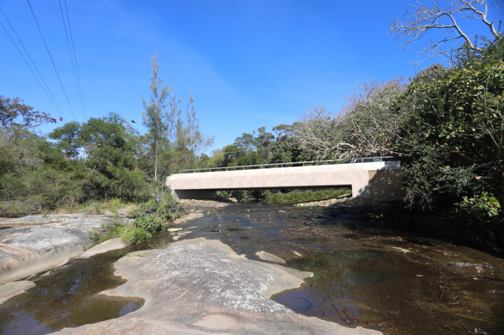
Fauna fencing will create a continuous protected corridor from Trefoil Creek to Oxford Falls Road. Concrete ramps inside culverts between Oxford Falls Road and Dreadnought Road will allow safe fauna movement beneath the road. Self-closing latches on pedestrian gates will prevent gaps in the fencing line.

Box Culvert Option.
Bridge Option. Photo Credit: Transport for NSW

Species that will benefit include swamp wallabies, possums, echidnas, bandicoots, reptiles and the threatened red-crowned toadlet.

More than 450 trees will be replanted across the project area, including Scribbly Gum, Coast Banksia, Long-Leaved Wattle and Sydney Peppermint. Cleared vegetation will be redirected for reuse in consultation with wildlife organisations.

Stay updated

The project is being staged to manage impact on the community and the environment, with activities scheduled during lower traffic periods where possible. Noise curtains and non-tonal reversing beepers will be used on site.

For updates, residents can call the project information line on 1800 684 490, email projects@transport.nsw.gov.au or visit click here.


Published 2-June-2026

Ertech Awarded $85 Million Contract to Upgrade Wakehurst Parkway as Construction Moves Toward Mid-2026

Construction firm Ertech has secured an $85.1 million contract to deliver long-awaited safety, capacity and flood improvement works along Wakehurst Parkway, with crews set to establish the site in the coming months and begin major works by mid-2026.


The contract award ends years of planning and community advocacy on a road that has become one of the Northern Beaches’ most persistent infrastructure frustrations. For Frenchs Forest, which sits at the southern end of the upgrade corridor near the intersection with Frenchs Forest Road East and Northern Beaches Hospital, the announcement means that the congestion and safety black spots that have affected the suburb’s daily road experience are finally moving from planning documents into construction machinery.

What Ertech Will Build

The $85.1 million project delivers works across three sections of the Parkway between Frenchs Forest Road at Frenchs Forest and Pittwater Road at North Narrabeen. At the southern end, closest to Frenchs Forest, a new southbound lane widens the section between Oxford Falls Road and Trefoil Creek to dual lanes, directly improving traffic flow on the approach to Northern Beaches Hospital from the north.

Photo Credit: Transport for NSW

At the Oxford Falls section, the Dreadnought Road and Oxford Falls Road intersections both receive significant upgrades. Dreadnought Road gains new bus stops, an additional signalised pedestrian crossing, a new southbound left turn slip lane and an extended right turn bay.

Oxford Falls Road receives a new southbound right turn bay and a dedicated northbound left turn lane. Additional lanes in both directions between these two intersections address one of the most congested stretches of the entire corridor. Flood improvement works at Oxford Falls are also included within the Ertech contract scope.

At the northern end near North Narrabeen, the project widens shoulders to improve traffic flow in both directions, creates a new left-turn bay into Mirrool Street, and reconfigures the Elanora Road intersection to improve sight lines and driver safety.

Community Concerns Around Elanora Road Remain

Not everyone is entirely satisfied with the approved design. The Elanora Heights Residents Association raised concerns about the proposed modifications at the Elanora Road intersection specifically, arguing the plan represented a design failure rather than an adequate safety solution.

The association proposed an alternative seagull lane configuration for the intersection. Transport for NSW investigated five options for the site and determined that the approved design, which includes installing a concrete median and reconfiguring the existing give way line and kerb line, provided the best outcome based on the available evidence.

The residents association also described the flood improvement works included in the contract as a partial solution that does not address the main flooding locations on the Parkway, nor wildlife protection concerns within the bushland corridor. Those broader flood mitigation works at other sections of the Parkway remain the subject of a separate $31 million program.

Improving Access for Residents

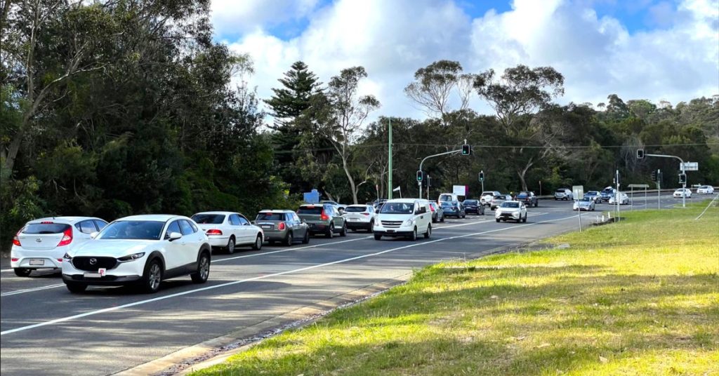
For Frenchs Forest residents, the southern section of the upgrade delivers the most immediate benefit. The dual lanes between Oxford Falls Road and Trefoil Creek address a bottleneck that has long slowed southbound traffic approaching the Frenchs Forest Road East intersection and, by extension, access to Northern Beaches Hospital.

That hospital access dimension has been central to the case for upgrading this section of the Parkway for years; when the road is congested or closed, the most direct route to the peninsula’s only major hospital becomes significantly less reliable.

Photo Credit: Transport for NSW

The Parkway closes six to seven times per year on average due to flooding, a pattern that has frustrated Frenchs Forest commuters and emergency vehicle operators alike. The flood works at Oxford Falls included in the Ertech contract represent one piece of that puzzle, targeting the smaller, more frequent rainfall events that drive most of those closures.

Construction is expected to take up to two years from the mid-2026 start. Residents can subscribe to project updates by visiting this link. Residents can direct enquiries to the project team on 1800 684 490 or via projects@transport.nsw.gov.au.


Published 31-March-2026.

Upgrades to Wakehurst Parkway Planned

About $75 million will be invested to improve safety and traffic flow at Wakehurst Parkway which will deliver upgrades to the 9.5-km stretch from Narrabeen to Frenchs Forest.


The funding is in addition to the $18.1 million already provided to the Northern Beaches Council for the flood mitigation project on Wakehurst Parkway. The new investment will deliver improved traffic signals at the Dreadnought Road intersection, upgrade the Oxford Falls Road West intersection, improve southbound lane capacity on approach to Frenchs Forest, and improve safety at Elanora Road

Upgrade to this section of Wakehurst Parkway will include localised widening and additional turning lanes to reduce crashes and improve the efficiency of the corridor.

“Sections of Wakehurst Parkway are some of the most dangerous black spots on the Northern Beaches, which is why we’re pressing ahead with our $75 million funding commitment,” Minister for Infrastructure Rob Stokes said.


“These works will help reduce crashes, improve access to Northern Beaches Hospital, and save commuters time by improving the overall efficiency of the wider road network.”

Minister for Metropolitan Roads Natalie Ward explained that Wakehurst Parkway is situated within an incredible bushland setting, “so these important safety improvements will be designed and delivered to minimise impacts on the local environment and community, with updates every step of the way.”

Also being undertaken are essential roadworks, including the asphalting of a 2.8-kilometre section of the road, which is funded through the NSW Government’s $147 million Greater Sydney State Roads Assets Restoration Program.

The first round of community consultation on the Wakehurst Parkway’s safety and traffic flow improvements is expected to take place in 2023.

Road Widening To Start Soon For Section Of Wakehurst Parkway

A section of Wakehurst Parkway will be widened to four lanes to reduce traffic congestion in the area and make it safer for motorists.


Read: Developer Proposes Rapid Assessment Of New Mental Health Facility In Frenchs Forest


Wakehurst Parkway, one of the most complained-about roads across the northern beaches, has witnessed a number of accidents and mishaps. Back in 2021, a serious collision in the area left two people seriously injured.

The $75-m road widening project will see the Parkway widened, in both directions, between the intersection with Dreadnought Rd at Oxford Falls, then south through the busy intersection with Warringah Rd to pass the intersection with Aquatic Dr at Frenchs Forest.Reducing Flood at Oxford Falls

wakehurst parkway
Photo credit: Change.org

After being presented with a flood mitigation feasibility study for Wakehurst Parkway, Council is now considering the next step for the project which involves progressing with detailed design and environmental assessments for reducing flooding at the Oxford Falls and Oxford Falls Road west sites.

This comes after Northern Beaches Council voted on 22 March 2022 to proceed with the detailed design and environmental assessments for the Oxford Falls site with a view to designs being completed by mid-2022 which will then allow construction to commence.

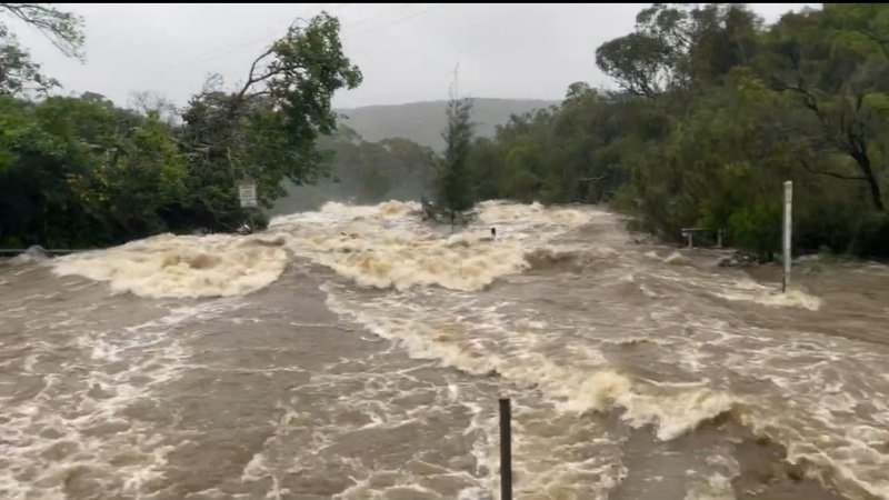
The Parkway north of Warringah Road is prone to flooding in certain areas and has historically experienced frequent road closures as a result. At present, this is up to six to seven times per year on average.

In the wake of March 2022 flooding, Oxford falls Road is closed between the Wakehurst Parkway and Aroona Road due to flooding.

oxford falls
Road closure in March 2022 (Photo credit: Live Traffic NSW/Facebook)

Initially, Wakehurst Parkway was deemed “not a priority,” with the mayor himself highlighting that it is a state road. He also added that the only way to permanently stop this road from flooding is to raise the road.

Community consultations revealed that while there is support for flood mitigation works, views diverged on the preferred method and the acceptability of the environmental impact.

“There is no doubt that Wakehurst Parkway closures are frustrating to motorists and we’d all like to see the flood issues fixed,” Mayor Regan said.  

“While a quick solution would be great, in the case of Wakehurst Parkway there is a lot of detail to consider along with environmental regulations and site constraints and multiple land ownership.”

Both federal and state funding will be used for the Wakehurst Parkway road widening project.